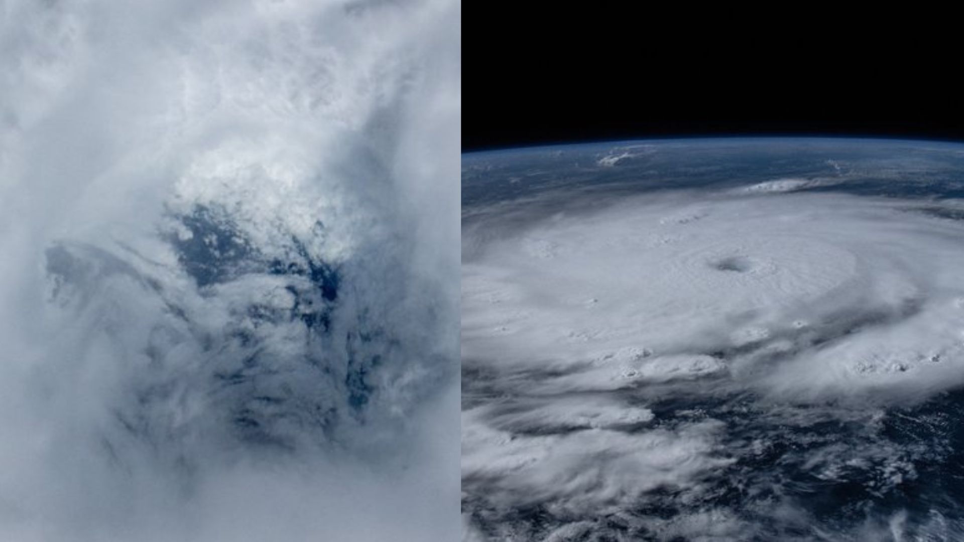
The International Space Station (ISS) captured remarkable footage of Hurricane Beryl, a powerful Category 5 storm in the eastern Caribbean. Filmed from about 400 kilometers above Earth, the video shows the immense scale and intensity of this potentially catastrophic storm.
Hurricane Beryl rapidly intensified to become the earliest Category 4 storm on record before strengthening to Category 5, with winds reaching up to 257 km/h. The storm’s eye was clearly visible from space, with NASA astronaut Matthew Dominick calling the view both “eerie” and exciting from a meteorological perspective.
Watch here the video of Hurricane Beryl seen from space:
Hurricane Beryl, a Category 4 storm with winds around 130 miles per hour, is seen over the Caribbean from the space station as it orbited above at about 9 a.m. EDT Monday morning. pic.twitter.com/eYH36rMU3E
— International Space Station (@Space_Station) July 1, 2024
The National Hurricane Center (NHC) has labeled Hurricane Beryl as “potentially catastrophic,” with its trajectory threatening Jamaica and other Caribbean islands. As of Monday, the hurricane was about 840 miles (1,352 km) east-southeast of Kingston, Jamaica’s capital.
Scientists attribute Beryl’s unusually early and intense formation to climate change, noting that warmer North Atlantic temperatures have likely contributed to its rapid development. This underscores the increasing impact of global warming on extreme weather events.
The storm has already caused significant damage in the eastern Caribbean, downing power lines and flooding streets. Hurricane warnings are in effect for several islands, including St. Vincent and the Grenadines, with forecasts predicting up to 10 inches (25 centimeters) of rain in some areas.
We flew right over the top of Hurricane Beryl today. Peering down into the eye with the 50 to 500 mm lens gave me both an eerie feeling and a high level of weather nerd excitement.
Whole Hurricane: 50mm, f9, ISO 1000, 1/32000
Eye: 210mm (50 to 500m lens), f13, ISO 1000, 1/26000 pic.twitter.com/731tEy0CJh— Matthew Dominick (@dominickmatthew) July 1, 2024
As Beryl continues its westward path, it is anticipated to bring life-threatening winds and storm surges to Jamaica later this week. The NHC forecasts rainfall amounts ranging from 4 to 8 inches (10 to 20 cm), with potential accumulations up to 12 inches (31 cm) in some areas.
Satellite imagery and footage from the space station provide essential data for meteorologists and emergency responders, enabling more precise forecasts and better preparation for affected regions.
Hurricane Beryl underscores the critical role of space-based observations in comprehending and mitigating the impact of such powerful storms on vulnerable communities.


