The European Space Agency has recently captured stunning pics of the connecting bridge Ram Setu, using the Copernicus Sentinel-2 satellite.
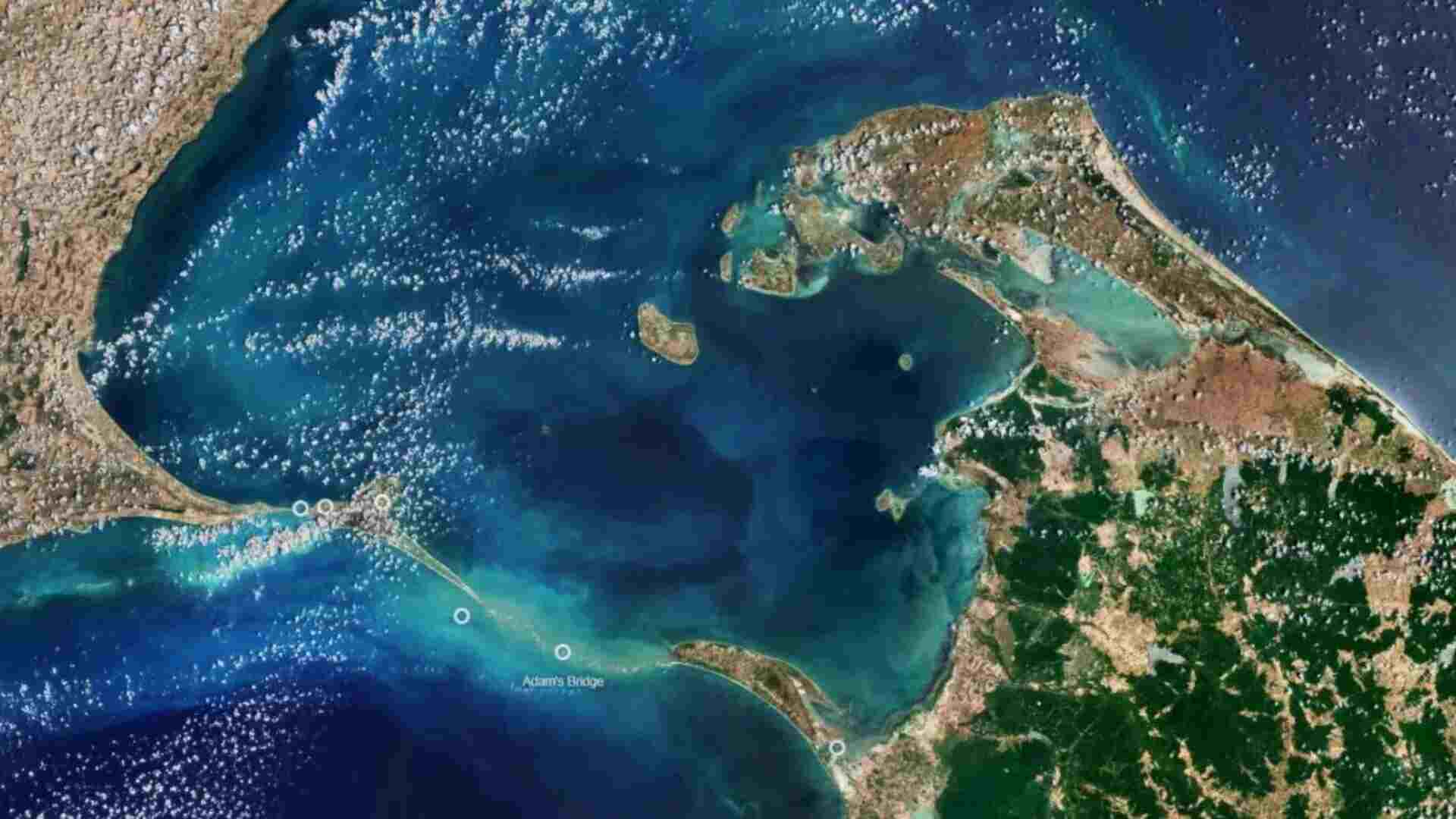
Ram Setu connects two countries- India and Sri Lanka. It stretches 48 km between Rameswaram Island and Sri Lanka’s Mannar Island.
It also divides the Gulf of Mannar in the south, an inlet of the Indian Ocean, from the Palk Strait in the north, an inlet of the Bay of Bengal.
But there are various theories related to this bridge. According to geological evidence, the limestone shoals found in the bridge, serves as evidence of the land, which once connected India and Sri Lanka.
As per historical records, this natural bridge remained active till 15th century, but gradually, the bridge got destroyed due to storms.
ESA’s Observations
While observing Ram Setu, ESA noticed, that some of the sandbanks in the bridge were dry and the sea in the area were shallow. which was only 1 to 10 meters deep, as the water was light in color.
Besides, both sections of Ram setu come under the category of protected national parks in both the respective countries- India and Sri Lanka.
The sand dunes function as a breeding ground for birds like brown noddy. Various species of fish and seagrasses live in shallow waters. The sea surrounding Ram setu also consist of dolphins, dugongs, and turtles.