A tropical depression forming over Cuba is becoming better organized and is forecasted to bring heavy rain and coastal flooding to much of Florida’s Gulf Coast, according to meteorologists on Saturday.
The storm intensified into a tropical depression late Friday and is expected to escalate into a tropical storm by Saturday night, with maximum sustained winds of 39 mph (63 kph) or more. If it attains tropical storm status, it will be named Debby, marking the fourth named storm of the Atlantic hurricane season.
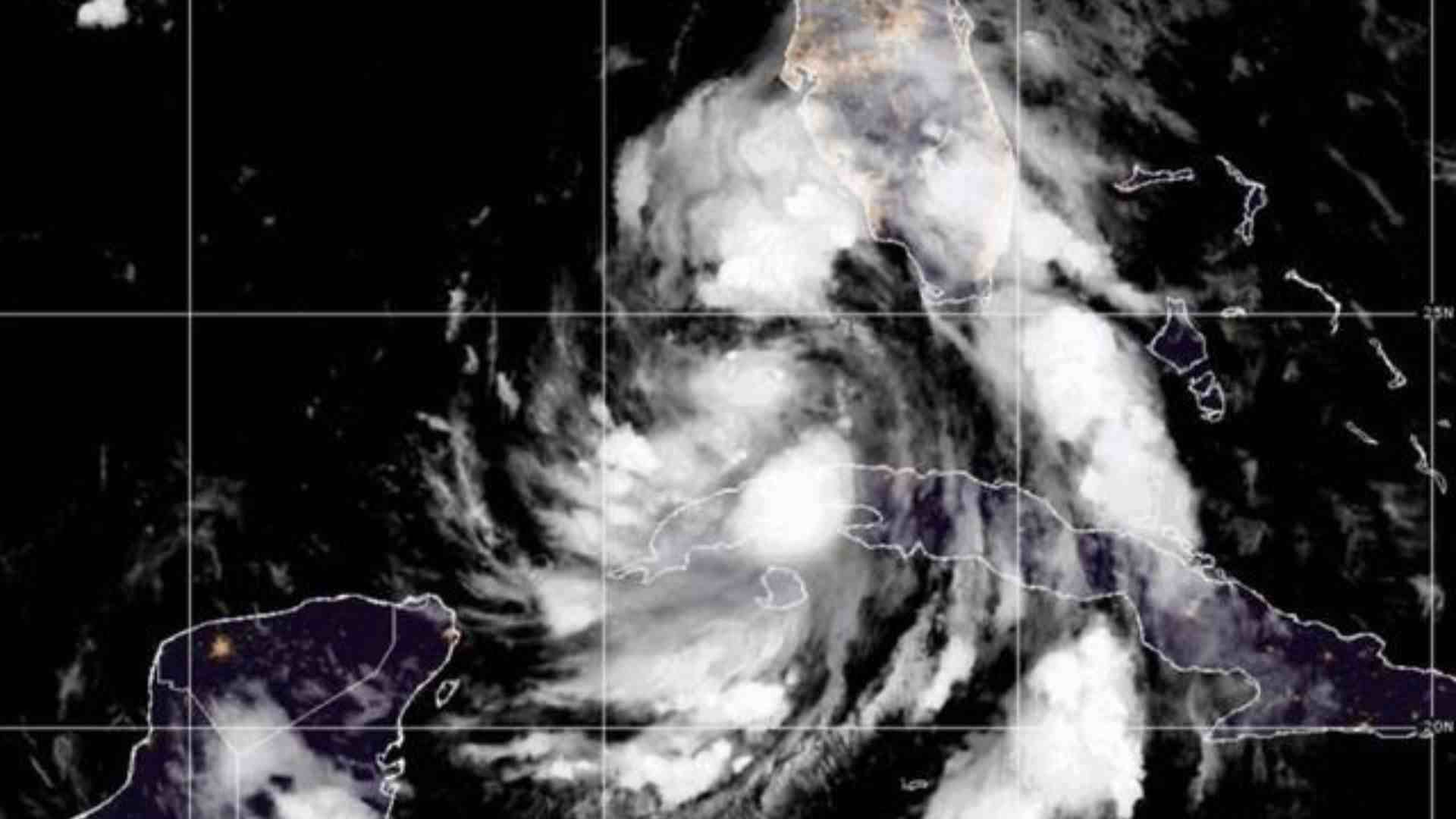
As of Saturday morning, the storm’s center of circulation was near Havana, but its associated winds and thunderstorms were dispersed across a broad area, including southern Florida, the Florida Keys, and the Bahamas. The National Hurricane Center in Miami predicts that the depression will gain strength as it moves northward off the southwest coast of Florida, where sea temperatures have been exceptionally warm, reaching 92 degrees Fahrenheit (33 Celsius) this week.
System Expected to Come Ashore as a Tropical Storm
Forecasts indicate that the system could make landfall as a strong tropical storm late Sunday or early Monday, crossing northern Florida into the Atlantic Ocean, where it is expected to remain a tropical storm affecting Georgia and the Carolinas early next week. Tropical storm warnings have been issued for most of Florida’s west coast and the Dry Tortugas, with a hurricane watch in place for parts of the Big Bend region, acknowledging the possibility that Debby could reach hurricane strength before making landfall.
On Saturday morning, the hurricane watch area was extended westward to Indian Pass in the Florida Panhandle. A warning signifies that storm conditions are expected within 36 hours, whereas a watch indicates that storm effects are possible within 48 hours.
Tropical storms and hurricanes have the potential to cause river flooding and overwhelm drainage systems and regional canals. Forecasters are predicting 5 to 10 inches (125 mm to 250 mm) of rain, which could result in “locally considerable” flash and urban flooding. Moderate flooding is also anticipated for some rivers along Florida’s west coast.
Some of the heaviest rainfall is expected next week along the Atlantic coast from Jacksonville, Florida, northward through Savannah, Georgia, and Charleston, South Carolina. Florida’s flat terrain is susceptible to flooding even during sunny days when king tides surge in coastal areas. The storm is forecasted to generate storm tides of 2 to 4 feet (0.6 to 1.2 meters) along most of Florida’s Gulf Coast, including Tampa Bay, with higher tides of 3 to 5 feet predicted in the sparsely populated Big Bend region. A storm surge warning issued on Saturday highlights the “danger of life-threatening storm surge inundation” in areas such as Hernando Beach, Crystal River, Steinhatchee, and Cedar Key.
At least two locations in the Florida Keys reported sustained winds of 30 mph (48 kph) on Saturday morning, though a tropical storm watch for the northern Keys was lifted. Despite windy and squally conditions on Long Key, Scott Battle, operator of Florida Boy Bar and Grill, described the situation as “fine.” “It’s spitting off and on and blowing a little, but not too bad,” he said by phone.