
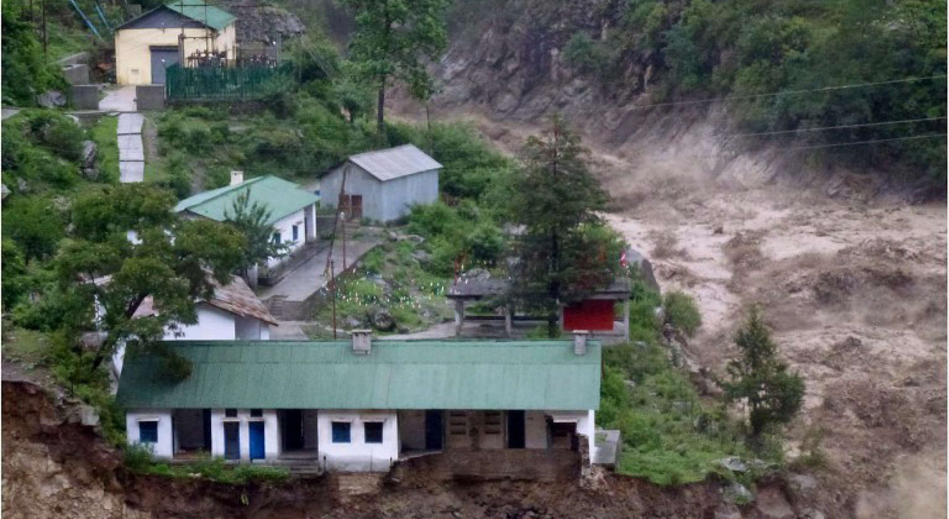
On February 7th, a sudden massive flood completely devastated a Himalayan valley in the state of Uttarakhand, tearing through two hydroelectric dams, killing at least 56 people while more than 150 are still missing. As a result of the flood, there has been massive flooding in Chamoli district- the Rishiganga river, the Dhauliganga river, and in turn the Alaknanda. As rescue efforts are still underway, the loved ones of those who are missing and watching the disaster unfold on national and international news are looking for explanations. Millions worldwide watching the humanitarian cost of the disaster have questions: how did this happen and more importantly, could we have known this beforehand? Let us stifle through all the media coverage and speculation about the cause of the devastation and find out what are the scientific explanations behind the outburst, the previous indicators of such a disaster, and whether of not Indian authorities are equipped to provide assistance to those in need in such a scenario.
WHAT HAPPENED IN UTTARAKHAND?
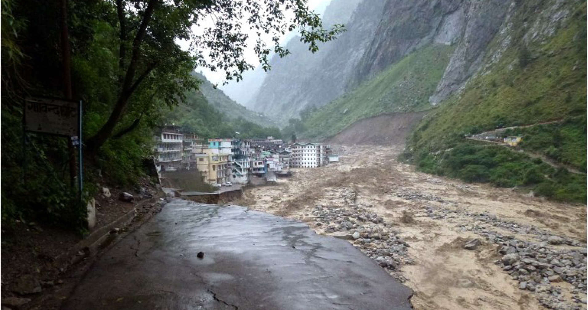
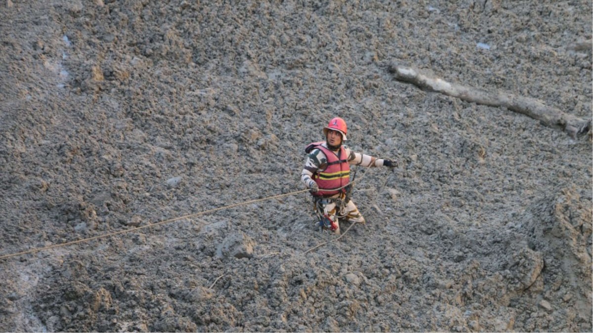
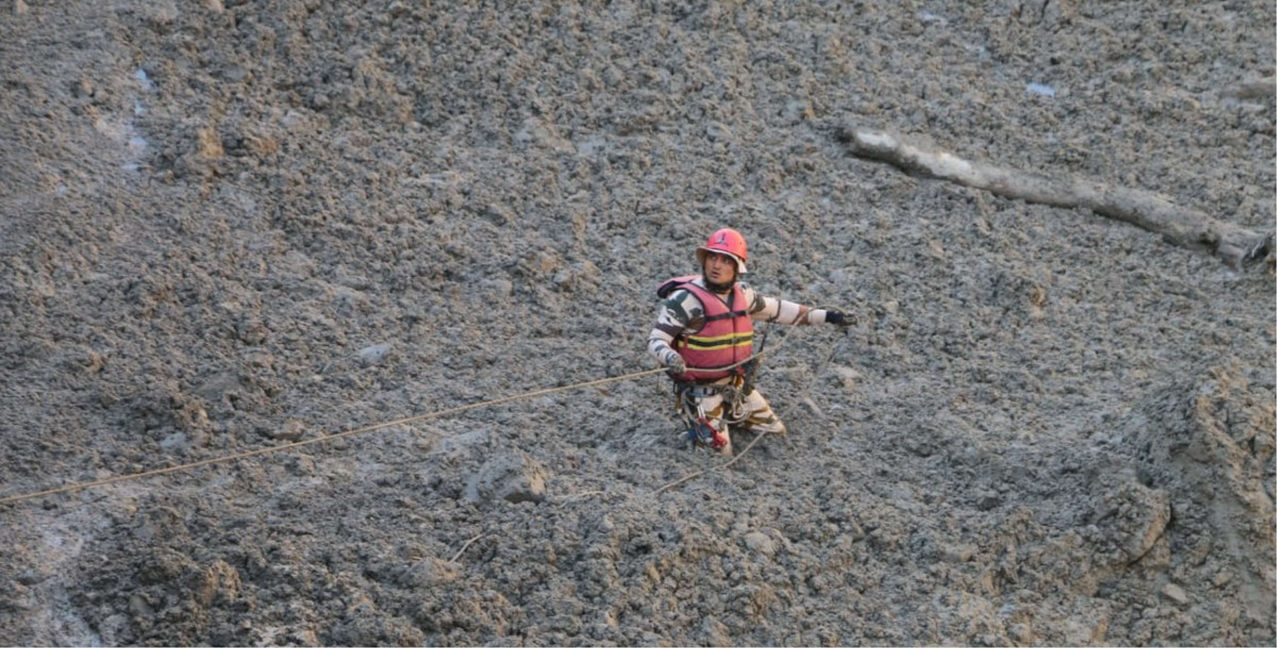
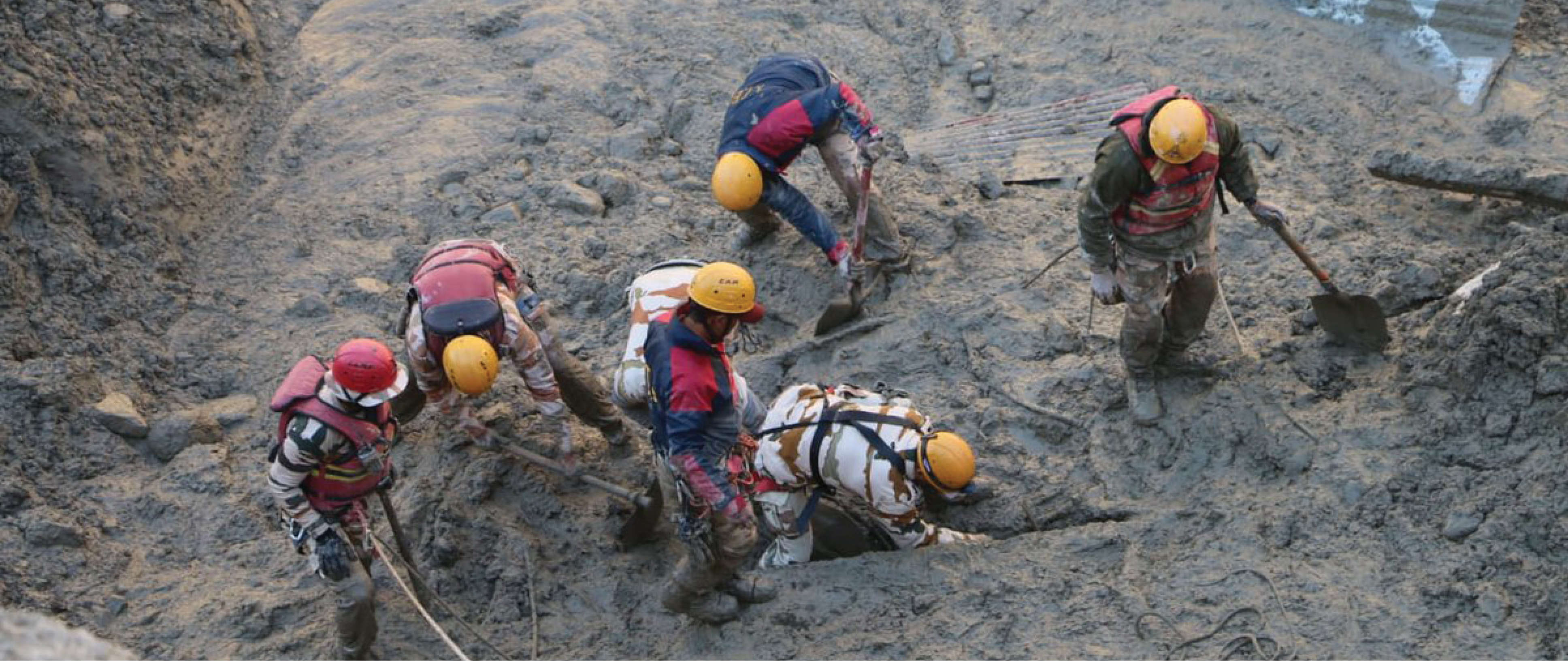
As per the Uttarakhand police, a flood hit the region at around 11:00 am IST on February 7th. The torrential fast-moving water, ice and debris first destroyed the Rishiganga hydroelectric project, and then continued along the Dhauliganga river where it hit the larger Tapovan Vishnugad hydro power construction project. Hundreds of construction workers had been working on the projects, many of whom are still missing. In the deluge of the flooding, bridges, roads, homes and hundreds of cattle were also swept away. For many who were watching the incident unfold on television, this was a tragic reminiscence of the floods that rocked Uttarakhand in 2013, when several days of heavy rainfall destroyed villages, killing almost 1,000 people. Unofficial estimates suggest this figure could be as high as 5,000.
WHAT IS THE CAUSE OF THE FLOODING?
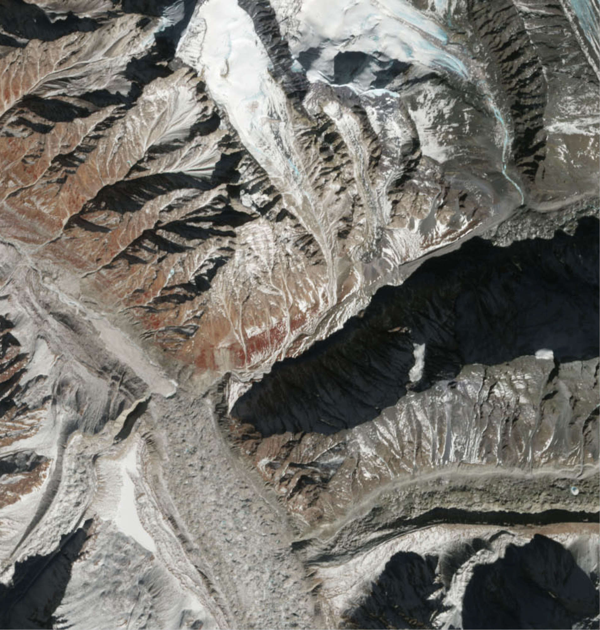
In the aftermath of the flooding, many reports and scientific studies suggested that the cause of the flooding was the outburst of a glacial lake. Glacial lakes are described as lakes that form behind national dams which are created by debris which accumulates in front of glaciers. As glacial fronts retreat, these are left behind. Due to rising temperatures which are melting glaciers around the world, thousands of such lakes are expanding rapidly. Glacial lakes can cause catastrophic floods if the natural dam breaks.
While many scientists believe that the flooding was a result of a GLOF or Glacial Lake Outburst Flood. This refers to the flooding caused downstream due to any form of breach in a glacial lake. While GLOFs are not unusual, their severity and impact would depend on various factors, including the size of the lake, burst and location. Similarly, the cause of the breach can also vary, and in this case, it could have been an avalanche in the region reported some days ago.
However, a few days after the event as more satellite imagery came to light, some scientists reported that the incident could have been caused by a breach in a temporary pool or lake formed by obstructions due to landslides or snow avalanches. This is referred to as a Landslide Lake Outburst Flood (LLOF). While many teams of scientists and experts have reached the area to study the actual cause, a definitive answer for the same isn’t clear yet.
Photograph by Press Information Bureau, India
IS CLIMATE CHANGE BEHIND THIS TRAGEDY?
While scientists are working to figure out the exact cause of the disaster, it can be said that this was not entirely a “natural” disaster. Uttarakhand in general and Chamoli specifically have always been a vulnerable and geologically unstable region. Increasing population and construction activities in the region have undoubtedly made it more vulnerable. Similar disasters have rocked the reigion in the past few decades. A massive earthquake which was attributed to the Tehri Dam killed 100 people in 1999. In 2004, a hydro-meteorological disaster caused a landslide, killing 16 people. Another similar incident in Chamoli killed 11. In addition to this, everyone also remembers the tragedy of the 2013 Uttarakhand floods which killed hundreds. So this begs the question: did we know something like this would happen again in Uttarakhand?
In June 2019, a study published in the journal Science Advances spanning 40 years of satellite observations across China, India, Nepal and Bhutan indicated that climate change is eating away at Himalayan glaciers. The study revealed that the glaciers have been losing more than 1.5 vertical feet every year since 2000. This is double the amount of melting that took place in 25 years before that (1975-2000). The study also indicated that the melting is consistent in time and space with rising temperatures recorded as a direct result of climate change and subsequent global warming. While the study shows that temperatures vary from place to place, they have averaged out to be one degree Celcius higher than those from 1975 to 2000. While Uttarakhand has seen such events in the past too, there is a definite possibility that this disaster also has a stamp of climate change, with regard to the origin of the flooding.
IS INDIA PREPARED FOR SUCH DISASTERS?
As per an inventory of glacial lakes by the National Remote Sensing Centre conducted 6 years ago, there was about 3 lakh such glacial lakes in the Indus, Ganga and Brahmaputra basins. Formation of glacial lakes in the Himalayan region is bound to increase due to the melting of glaciers. The immediate step required would be to identify such water bodies and put structural measures in place. The construction of a safe outlet passage or infrastructure to pump out excess water from the lakes would also be required. While India conducts remote sensing activities to identify such lakes, no such structural measures have been taken.
Constantly monitoring such lakes and placing early warning systems are essential. Although different players such as the Geological Survey of India (GSI), Environment Ministry, India Meteorological Department, National Remote Sensing Agency carry stakes in the process, India still lacks in that regard. As glaciologist Anil V.Kulkarni states, the first step would be to keep track of indicators such as water level, measures of rainfall in the catchment areas. There has to be a community-driven mechanism where the people residing in downstream areas are warned immediately and damage avoidance and control measures are put in place.
Similarly, many believe that the construction of structures in the vicinity of disaster-prone areas tends to increase the possibility of landslides. Formation of fragile and weak habitations in downstream areas and building of structures such as dams without proper Environmental Impact Assessment are some of the factors that increase the impact of GLOF. India has lagged behind in enforcing strict regulations and standards towards constructing homes and other structures.
Due to the remoteness of the area, and lack of research and development funding, the Himalayan region continues to be one of the least monitored regions in the country. Many experts have called for an increased need for government funding to ensure better monitoring of this incredibly vulnerable region. This would be the only way to ensure that more is known about what goes on in the area, which would, in turn, help governmental agencies, enforcement authorities and people to develop better adaption practices.
Contributing Reports by Damini Mehta, Junior Research Associate at Polstrat