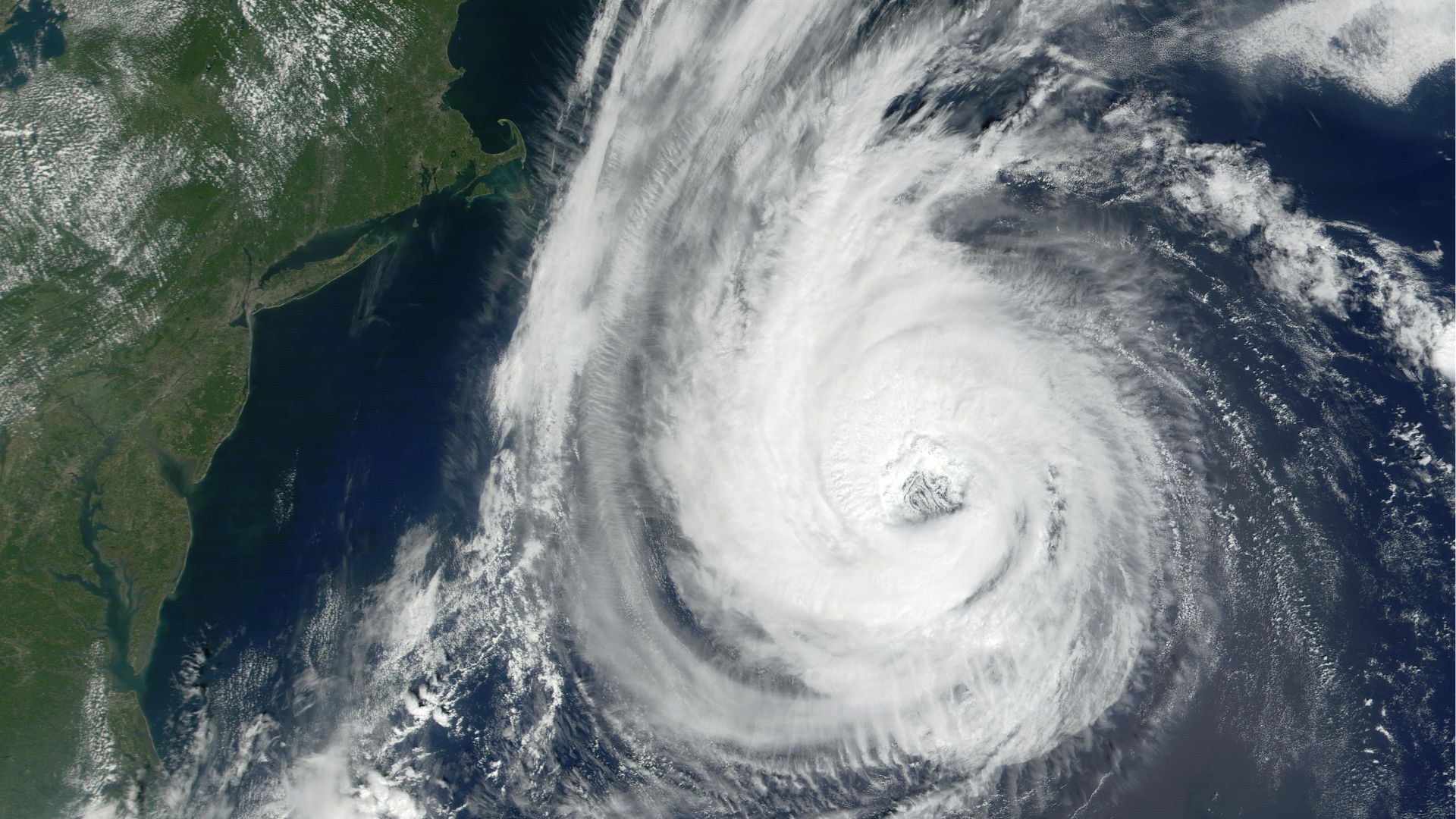
Hurricane Erin has intensified into a Category 4 hurricane, raising serious concerns both in the United States and across the Atlantic. A state of emergency has already been declared in parts of North Carolina, where officials are preparing for dangerous conditions. On Tuesday, waves reaching 20 feet are expected to crash onto the Outer Banks, posing a severe threat to coastal areas. The storm has already brought torrential rain to the southeastern Bahamas and the Turks and Caicos Islands, while also threatening the US East Coast with life-threatening conditions.
Remnants Could Hit the UK
Although Hurricane Erin is not expected to make landfall in Britain, its remnants could still bring strong winds and heavy rain to the region. The UK Met Office has forecast wet and windy conditions in southern and western areas in the coming days, even though Erin remains nearly 5,000 kilometres away. Reports in the country suggest that the storm may generate a 1,000-kilometre-long “wall of rain” across western parts of the UK.
Meteorologists Explain the “Wall of Rain”
BBC meteorologist Simon King clarified that the so-called “wall of rain” should not be taken literally. He explained it as “any low pressure containing remains of the strong storm,” which could stretch as wide as 600 miles. This means the storm’s remnants could bring prolonged rain and unsettled weather as Erin weakens while moving across the North Atlantic before reaching Britain.
A Met Office official told the Daily Mail: “A deep area of low pressure linked to Erin is likely to develop in the North Atlantic, with the final week of August possibly seeing Atlantic systems progress over the UK, especially in the North and West.”
Heatwave to End With Stormy Weather
Currently, the UK is experiencing unusually hot weather, with temperatures in London soaring to 30°C. However, forecasters believe this heatwave will soon end as Erin’s remnants push into the region, bringing wind, rain, and thunder. The shift could mark a dramatic change in Britain’s late-summer weather.
Record-Breaking Intensification
Experts have noted that Hurricane Erin is among the fastest-strengthening storms on record. According to AccuWeather senior meteorologist Alex Sosnowski, “Erin’s already large size and intensity are acting like a giant plunger on the sea surface.” The storm intensified from a tropical storm to a Category 5 hurricane in just over 27 hours, before later reducing in strength to Category 4.
Evacuations in the US
The storm’s power has already forced large-scale evacuations. Nearly 38,000 people in North Carolina have been moved to safety as officials brace for dangerous winds, flooding, and coastal erosion. While the UK is unlikely to face the same level of destruction, meteorologists warn that Erin’s remnants will still disrupt weather patterns across the country.


