
Six Assam police officers were killed on July 26 when an ancient boundary issue between Assam and Mizoram erupted in violent violence at a disputed border site. Residents of Assam and Mizoram battled twice in a week over territory in October last year, injuring at least eight people and torching a few homes and small shops. On the 26th of July, Home Minister Amit Shah intervened to restore order.


IN REGARD TO VIOLENCE
Unidentified persons set fire to eight vacant farm cottages near Aitlang stream on Sunday about 11:30 p.m., according to Mizoram deputy inspector general of police (northern range) Lalbiakthanga Khiangte. However, Assam police reported that unidentified protesters threw stones at them on Monday, injuring at least half a dozen of its employees in Cachar district. Locals also said that police officers from Assam were attacked with sticks and rods in Lailapur.
Mizoram Chief Minister Zoramthanga claimed that the Assam government had “intruded” into Mizoram’s territory and displayed “aggression.” “The Government of Mizoram wishes to address the inter-state border dispute with Assam in a peaceful and amicable manner.” Both of the northeastern states’ chief ministers had met.
DISPUTE THAT HAS BEEN GOING ON FOR A LONG TIME
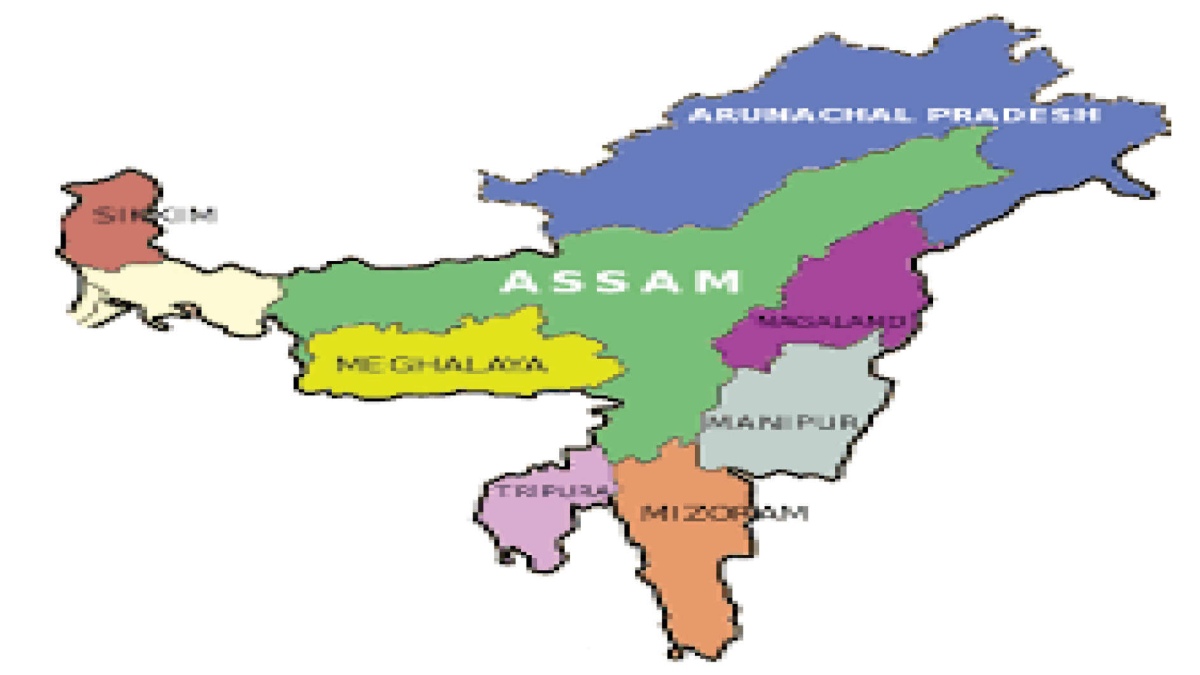
This isn’t a one-time occurrence. It’s been a long-running feud for over a century. The 164.6-kilometer border between Assam and Mizoram is at the centre of the problem. Assam’s Cachar, Hailakandi, and Karimganj districts share a border with Mizoram’s Kolasib, Mamit, and Aizawl districts.
The Northeastern Areas (Reorganisation) Act of 1971 carved out three new states in the region, namely Manipur, Meghalaya, and Tripura, from Assam. The Union Territories of Mizoram and Arunachal Pradesh were also established.
THE HISTORY OF THE DISPUTE
Showdowns between Assam and Mizoram people are less common than, example, Assam and Nagaland residents in the intricate border equations of the Norteast. Despite this, the current 165-kilometer border between Assam and Mizoram comes from the colonial era, when Mizoram was known as Lushai Hills, an Assam region.
The controversy comes from two notifications: one from 1875 that distinguished the Lushai Hills from the Cachar plains, and another from 1933 that established a border between the Lishai Hills and Manipur. According to Mizoram, the boundary should be drawn according to the 1875 announcement. Mizo authorities have previously complained that Mizo society was not consulted when the demarcation was announced in 1933. The Assam administration adheres to the 1933 delineation, which was the source of contention.
Following the Mizo peace treaty struck between the Mizos and the Union government in 1987, Mizoram was proclaimed a state. While the 1933 agreement served as the foundation for the state, the Mizos insist on using the previous boundaries. Along the border, there have been regular conflicts.
DO ASSAM AND MIZORAM HAVE AN AGREEMENT?
Assam and Mizoram have struck an agreement under which the status quo in no-land, man’s or the border area, will be maintained. However, this hasn’t put an end to the squabbles. In 2020, the central government was forced to intervene to break a deadlock after border clashes resulted in an unofficial roadblock on Mizoram’s lifeline, National Highway 306.
Mizoram, a landlocked state, relies on this road to receive supplies from the rest of the country.